The Houston Chronicle recently published a great article by Dylan Baddour about recent work by TBG Partners at the Wetland Park in Riverstone, a master planned community in Sugar Land, between the Brazos River and State Highway 6. It has been planned, designed, financed, and built by the Johnson Development Corporation.
The article was generally about how master planned communities are moving away from formal parks, golf courses, and playgrounds and starting to provide more natural environments for recreation. This could include things like real wood and stones for kids to climb on, mud puddles, native grasses and other plants, and direct access to water to see and touch tadpoles. The National Wildlife Federation has suggested that facilities like this provide opportunities for people to conduct “nature play.” The Natural Learning Initiative at North Carolina State University has published guidance on how to plan and design nature play facilities.
The story highlighted how TBG Partners landscape architect Meade Mitchell designed the Wetland Park, located just east of LJ Parkway and a bit north of University Boulevard. The Wetland Park is among the newest amenities and it provides a sharp contrast to a more traditional, hardscape amenity area called Riverstone Club, located a bit to the southwest. The Club includes tennis courts, a dog park, pools, and gym facilities. See map below.

Aerial view of riverstone with insets and labels prepared by m. bloom
from GOOGLE EARTH image and riverstone landplan dated february 2017.
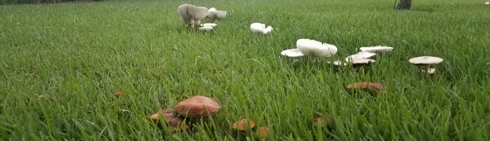
The Wetland Park includes a mud pie kitchen, rock throwing targets in ponds, a bridge with no handrails to make it easier to watch aquatic life, logs and natural wood placed in ponds for aquatic habitat, and a pathway of partly submerged rocks to encourage wet feet.
When I was a kid I played in Shortridge Memorial Park in the headwaters of the East Branch of Indian Creek just outside of Philadelphia. Building dams, catching crayfish. So I would love to live in a place with these types of amenities.

East Branch of Indian Creek, shortridge memorial park,
Wynnewood, PA. Image from Google Earth.
A close look at the 2017 aerial photography of the development from Google Earth illustrates that a traditional underground storm sewer system serves the residential lots and streets. It also shows how engineers provided large excavated areas to hold and slowly release stormwater runoff from the development. These are called detention basins (or ponds) and they hold some water permanently to provide lake features for residents to enjoy. When it rains, water runs off the roofs, the yards, the driveways, and roads, and drops into concrete storm sewer pipes. The water is rushed quickly to the detention ponds, which fill up to their full capacity to store the excess water. Small discharge pipes then release the water at a rate that is less than or equal to the pre-development runoff rate. This prevents the development from flooding downstream properties.
This traditional approach of speeding up the runoff along curbs and gutters and inside storm sewers only to slow it down inside large detention basins is not very efficient.
What if we conveyed rain water away from the homes and structures using natural topography? If the land is too flat, what if we graded and planted the landscape to create drainage corridors that look like creeks or bayous? What if we preserved and extended the existing wetland areas and creeks into the community so that families could interact with natural creek corridors throughout it? The natural drainage concept does this.
Natural drainage allows rain water to flow and collect in natural creek corridors more slowly. This reduces the volume of detention required to protect downstream properties. Natural drainage corridors bring nature next door. They provide a drainage infrastructure service as well as a valuable water-based linear amenity.
The natural drainage approach can help avoid regulated wetlands and can help integrate them into the overall land plan in a way that can preserve their function and connection to other waters. Natural drainage corridors also provide a place for hike and bike trails and enhance community connectedness. The natural drainage approach fits perfectly with the nature play approach and visa versa.
The natural drainage approach helps enhance the economic performance of real estate projects by providing:
- Higher operating income;
- Faster sales;
- Higher amenity values for more of the community;
- Greater lot yield (through reduced detention requirements);
- Green marketing benefits; and,
- Reduced drainage infrastructure costs.
The Wetland Park in Riverstone is a great step in the right direction and I applaud all who were involved in its creation, but we can do even better using integrated natural drainage and nature play concepts. We can integrate the natural world with the built environment by combining wetlands preservation, drainage, linear trails, connectivity, and recreational natural play environments all into the same system, all while enhancing the economic performance of the community.